

Home › Motorcycle Rides › La Cañada Flintridge
RideWolf · La Cañada Flintridge
The biggest mountain road in Southern California starts at your stoplight. Everyone else rides an hour just to get here. You live at mile zero. Get a crew to climb it with.
You’re on the list — we’ll be in touch. Now go ride.
Free to join. The first 500 riders from the foothills get a permanent Wolf Pack badge.
La Cañada Flintridge has one intersection every rider in Los Angeles County can picture: Foothill Boulevard and Angeles Crest. On a clear Sunday the parade starts before eight. Singles, pairs, whole packs rolling off the 210, topping off at the corner pumps, and pointing uphill. By lunch they’re scattered across 60 miles of mountain, and the town is quiet again. The best riding traffic in the county passes through here every single weekend. Passes through. That’s the whole story of this place, and it’s the reason this page exists.
My own start was backwards from most riders’. I waited 30 years to get on a bike, finally did it at 50, and then got handed a crew almost immediately: my sister-in-law knew riders, and Leo and the guys took me in before I could even ride my own bike home. I skipped the hard part by pure luck.
Living here and riding is the strangest version of the hard part. You are surrounded by riders every weekend. In packs. In waves. For about ten seconds at a time, at the light, headed uphill, gone. The scene isn’t missing in La Cañada; it’s just never staying. Ask anyone in LA where the places to ride a motorcycle actually are and Angeles Crest is the first word out of their mouth. You’re already standing on it. What you don’t have is the group chat that decides when to meet at the pumps, and no amount of living at mile zero fixes that on its own.
The Crest is the marquee, and it earns it. From the base in La Cañada it’s 66 miles of proper engineered mountain highway to Wrightwood: banked sweepers low down, switchbacks through the middle, thin pine air up top near Dawson Saddle, the highest paved point in the range. Nine and a half miles up, the road forks at Clear Creek and gives you the quieter option: Angeles Forest Highway over Mill Creek Summit toward the desert. Link the two with Upper Big Tujunga Canyon Road and you’ve got the Triangle, the loop half the bikes at the base pumps are actually there to ride.
Two honest warnings, because this mountain punishes casual. CHP works the Crest hard, especially the lower half on weekends, and there is no fuel from the base until Wrightwood, 66 miles later. Top off at the bottom, every time. In winter and after storms, Caltrans gates the upper sections; check Caltrans QuickMap for CA-2 status and LA County road closures for Angeles Forest before you commit to the full day.
| The ride | What it is | ~Length | Skill | Where to meet |
|---|---|---|---|---|
| Angeles Crest Highway (CA-2) | The full run: Foothill Blvd to Wrightwood over Dawson Saddle (~7,900 ft) | ~66 mi | Intermediate+ | Last-gas pumps at Foothill & ACH |
| The Triangle | ACH up, Upper Big Tujunga across, Angeles Forest home — the local classic | ~45 mi loop | Intermediate | Clear Creek junction |
| Angeles Forest Hwy | The quieter fork: over Mill Creek Summit toward Palmdale | ~25 mi | Intermediate | Mill Creek Summit rest area |
| Red Box & Mt. Wilson spur | First mountain miles: 14 to the Red Box saddle, then the 5-mile spur to the observatory gates | ~19 mi one way | Beginner–Int | Red Box parking lot |
| The winter short run | Base to Red Box or Clear Creek when the upper gates are closed — still a real ride | ~14 mi one way | Beginner–Int | Back at the base pumps |
If you’re newer, don’t let “Intermediate+” scare you off the mountain entirely. The bottom 14 miles to Red Box are wide, well surfaced, and honest about their curves. Ride them until they’re boring, then go higher. If the fundamentals still feel shaky, get those sorted first; the Crest will still be there.
The ritual starts at the corner station at Foothill and Angeles Crest: the last gas before the mountain, and the closest thing the Crest has to a front porch. Somebody’s always topping off, checking a tire, waiting on a buddy. Up the hill, the regroup points are Red Box (parking, restrooms, and half the bikes on the mountain on a Sunday morning) and the Clear Creek fork, where groups sort out who’s doing the Crest and who’s cutting to Angeles Forest. Newcomb’s Ranch, the roadhouse every rider still names first, has its doors closed; people still pull into the lot out of thirty years of habit. Push the full 66 and lunch is a café table in Wrightwood.
The town itself keeps a lower profile. Descanso Gardens draws the cars, and JPL sits at the west end: they can land a rover on Mars, but their mail still says Pasadena. For riders, La Cañada is the base camp. The gathering happens at the pumps and up the hill, which is exactly why it’s so easy to ride here for years and never actually meet anyone.
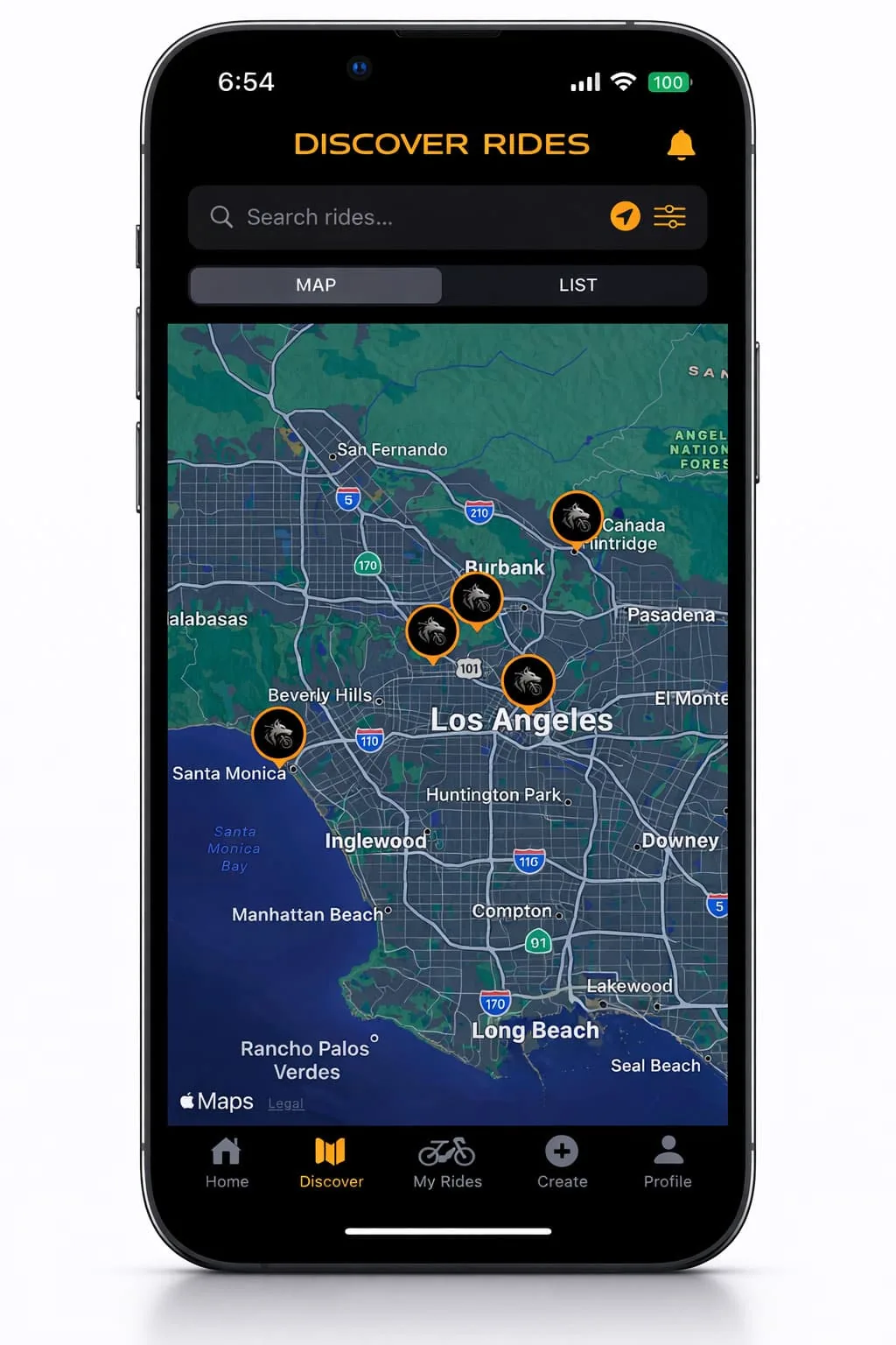
RideWolf is built to catch exactly the riders who already stream past your corner every weekend. It works like this:
Get on the early-access list for the foothill towns. No club, no dues, no waiting for someone at the pumps to talk first.
We match you with riders across La Cañada, La Crescenta, Montrose, and Pasadena who ride your pace and want the same mountain you do.
Meet at the base, top off together, and climb to Red Box with people who’ll wait at the fork. Brush up on your hand signals first; comms drop out fast in those canyons.
I waited 30 years to ride because nobody around me rode, and when I finally started at 50, a crew fell into my lap through family. I know exactly how lucky that was. RideWolf exists so the rider fueling up next to you at the base of the Crest doesn’t have to stay a stranger. If you’re in La Cañada, you live closer to the best road in the county than anyone I know. Come ride it with people.
— Johnny, founder. Started at 50, rides Sundays with the crew that took him in.
Sixty-six miles of Crest, one fork, one loop, and a corner gas station where it all starts. All that’s missing is the crew. Free to join, and the first 500 foothill riders wear the Wolf Pack badge for good.
You’re standing on the answer. Angeles Crest Highway starts at Foothill Boulevard and runs 66 miles over the range, Angeles Forest Highway forks off at Clear Creek toward Mill Creek Summit, and the Triangle loop links the two through Upper Big Tujunga. For group rides rather than solo miles, RideWolf matches you with riders across the foothill towns so the crews forming at the base pumps include you.
Check before you gear up: Caltrans gates sections of CA-2 in winter and after storm damage, sometimes for months. Caltrans QuickMap shows live CA-2 status, and LA County’s road closure page covers Angeles Forest Highway. The lower stretch from La Cañada to Red Box is the most reliably open piece, which is why it’s the default short ride here.
At the bottom, every time. The station at Foothill and Angeles Crest is the traditional last gas, and it’s genuinely the last: there’s no fuel on the mountain until Wrightwood, about 66 miles up and over. Riders who skip the ritual end up coasting into Wrightwood on fumes or turning around early. Top off, then climb.
The bottom 14 miles are, ridden with respect. La Cañada to Red Box is wide, well surfaced, and predictable, with parking and restrooms at the top to regroup. The middle and upper mountain add exposure, elevation, and long gaps between help, so earn those in stages. And watch your speed everywhere: CHP patrols this road as heavily as any in the county.
The local classic: climb Angeles Crest from La Cañada, cut across Upper Big Tujunga Canyon Road, and come back on Angeles Forest Highway, about 45 miles of mountain with almost no repeated pavement. It’s the ride to do when you want the Crest’s best corners without committing to the full 66 miles to Wrightwood and back.
No. The famous roadhouse partway up the Crest is closed, and riders still pull into the lot out of habit because it was the mountain’s living room for decades. Plan your stops around Red Box, Mill Creek Summit on the Forest side, or a café in Wrightwood at the far end, and carry water either way.
Full disclosure from me: my crew hasn’t made this climb yet. The Crest sits at the top of our list, and it’s been there long enough that the guys are tired of hearing me bring it up. When we finally ride it, it starts at those pumps. Maybe you’ll be there.
See you at the pumps. — Johnny