Home › Motorcycle Rides › Colorado
RideWolf · Colorado
Three paved roads above 12,000 feet, a shelf highway with four different stories about its name, and a season that runs backwards from the desert states. Colorado has more real motorcycle roads than almost anywhere in the country. What it doesn’t have is a way for the riders on them to find each other.
You’re on the list. We’ll be in touch. Now go ride.
Free to join. The first 500 Colorado riders get a permanent Wolf Pack badge.
Colorado had 176,484 registered motorcycles in 2024 by the federal count, and the riding here organizes itself around roads, not neighborhoods. You meet people at the top of Monarch Pass, you nod at the overlook, and you never see them again. The Front Range has the dealers, the bike nights and most of the riders. The roads that made the state famous start two or three hours west of all of it, in towns of a few hundred people with one gas station that may or may not be open in October. A rider in Aurora and a rider in Grand Junction can run the same pass on the same Saturday and have no idea the other exists.
I’ll be straight about where I stand with Colorado: nowhere yet. I started riding at 50 in Los Angeles, and every pass on this page is a line in my notebook, not a mile on my odometer. What I do know is the shape of the problem, because I lived it. I wanted a bike for thirty years and didn’t know one person who rode. Family finally connected me to riders, and that one piece of luck is the whole reason riding stuck. Colorado hands out that luck thin. The distances are bigger, the towns are smaller, and the season is shorter. You can’t afford to waste a July weekend riding alone because you don’t know anyone. That’s the gap this page, and this app, exist to close.
Elevations are CDOT’s own pass list unless the agency that runs the road says otherwise. Lengths marked with a tilde are routing estimates, not agency figures. Every road here is paved end to end. The dirt ones people will tell you about (Kebler, Phantom Canyon, Shelf Road, Gold Camp, Old Fall River, the Alpine Loop) are not on this list for a reason.
| The road | What it is | Length | High point | Season |
|---|---|---|---|---|
| US-550 Million Dollar Highway (Ouray → Silverton → Durango) | Shelf road over Red Mountain, Molas and Coal Bank passes; long stretches with no guardrail | ~70 mi | 11,018 ft | Year-round; winter avalanche-control closures |
| San Juan Skyway (US-550, CO-62, CO-145, US-160) | 236-mile All-American Road through Ouray, Telluride and Durango | 236 mi | 10,222 ft (Lizard Head) | Year-round |
| CO-82 Independence Pass (Aspen ↔ Twin Lakes) | Narrow switchbacks over the Continental Divide, rockfall, 35-ft vehicle limit | 37 mi gated | 12,095 ft | Late May to late Oct/Nov (shut Nov 17, 2025; opened May 21, 2026) |
| Trail Ridge Road, US-34 (Estes Park ↔ Grand Lake) | Eleven miles above treeline through Rocky Mountain National Park; timed entry applies to bikes | 48 mi | 12,183 ft | Late May to mid-Oct/Nov (shut Nov 14, 2025; opened May 29, 2026) |
| Cottonwood Pass (Buena Vista → Taylor Park) | County-run alpine pass, paved both sides since 2019, higher than Independence | ~31 mi | ~12,120 ft | Late May to early Nov (shut Nov 3, 2025; opened May 22, 2026) |
| US-50 Monarch Pass (Salida ↔ Gunnison) | Wide Divide crossing with truck traffic | ~65 mi | 11,312 ft | Year-round |
| Top of the Rockies (US-24, CO-91, CO-9 around Leadville) | Tennessee, Fremont and Hoosier passes around the highest big town in the state | 115 mi | 11,541 ft (Hoosier) | Year-round |
| US-160 Wolf Creek Pass (South Fork ↔ Pagosa Springs) | Seven percent grade for more than eight miles on the west side | ~43 mi | ~10,850 ft | Year-round |
| CO-149 Silver Thread (South Fork → Creede → Lake City) | Remote passes, about 50 miles between towns, no cell service in places | 117 mi | 11,361 ft (Slumgullion) | Year-round, no scheduled closure |
| US-50 plus Black Canyon South Rim (Montrose → Gunnison) | Blue Mesa reservoir sweepers and a seven-mile rim road | ~64 mi + spur | — | US-50 year-round; rim road late Apr to mid-Nov |
| CO-92 Black Canyon north side (Hotchkiss → Blue Mesa Dam) | Continuous rim curves above the canyon; no fuel documented | ~55 mi | — | Year-round, icy late fall to spring |
| CO-141 Unaweep-Tabeguache (Whitewater → Gateway → Placerville) | Remote red-rock canyon; CDOT says bring a full tank | 133 mi | — | Spring to fall |
| CO-65 Grand Mesa (I-70 → Cedaredge) | Climb onto a flat-top mesa; fill up in Cedaredge first | 63 mi | ~11,000 ft | Open; Lands End spur closed in winter |
| Rim Rock Drive, Colorado National Monument (Fruita ↔ Grand Junction) | Slow, exposed rim road with three tunnels; $20 per motorcycle | 23 mi | — | Open year-round |
| CO-133 McClure Pass (Carbondale → Redstone → Paonia) | River valley and one easy pass, hot springs beside the road | ~58 mi | 8,755 ft | Year-round |
| CO-17 La Manga and Cumbres (Antonito → Chama, NM) | Two passes beside a working steam railroad | ~48 mi | 10,230 ft (La Manga) | Year-round |
| CO-12 Highway of Legends (Walsenburg → Cuchara → Trinidad) | Spanish Peaks loop | 82 mi | 9,941 ft (Cucharas) | Year-round |
| US-40 Rabbit Ears Pass (Kremmling → Steamboat Springs) | Easy high pass ending at a hot-springs town | ~52 mi | 9,426 ft | Year-round |
Start with the one everybody argues about. Nobody agrees why US-550 between Ouray and Silverton is called the Million Dollar Highway. The state tourism office says it either cost that much to build or has that much gold ore in the roadbed fill. Durango’s office offers million-dollar views, or locals who said they wouldn’t drive it for less. Ouray’s office tells a story about three 1920s construction bids that added up to exactly one million dollars. CDOT, which actually maintains the road, gives no origin at all. What nobody disputes is the drop. The state’s own line is that many parts of the road have “drop-offs that lack guardrails,” and Ouray’s tourism office explains why with the cheerful note that in winter “they simply plow the snow off the side of the highway.” This summer the road showed its other face: a wildfire closure north of Ouray in June, a two-day flood closure at the end of July that left debris four feet deep across eight slide paths, and a retaining-wall repair at mile 88.6 running one-lane signals into October. Check cotrip.org the morning you ride it. If the pass is shut, CDOT’s detour through Telluride adds about an hour.
Then the twelve-thousand-footers. Independence Pass is the famous one: narrow, no shoulder to speak of, and rockfall is a normal Tuesday. Cottonwood Pass, one valley north, is actually higher and has been paved on both sides since 2019, so it belongs on a street bike’s list now. Trail Ridge Road is the one the National Park Service calls “the highest continuous paved road in the United States,” eleven miles of it above treeline, and it carries the catch that surprises most riders: your bike needs a timed-entry reservation between 9 a.m. and 2 p.m. in season. The two roads that climb higher still, Pikes Peak Highway at 14,115 feet and Mount Blue Sky at 14,130, are priced per person or per ticket and belong to Colorado Springs and Denver respectively. Both get their own pages here soon.
The Western Slope is where the fuel math gets serious. CDOT’s own advice for the Unaweep-Tabeguache byway is to “Bring full tank of gas, food and water,” and that’s the agency talking, not me. Grand Mesa’s byway has no gas between Cedaredge and the far end. The Black Canyon’s north rim road, CO-92, has no fuel documented anywhere along it. Rim Rock Drive outside Grand Junction is the easy day: 23 miles of slow rim road through three tunnels, headlights on, bighorn sheep possible, twenty dollars at the gate.
Down south, the roads get long and the towns get far apart. CDOT describes Wolf Creek Pass’s west side as a 7 percent downhill grade for more than eight miles with “a dangerous hairpin curve six-and-a-half miles from the summit,” and that page was written for truckers who kept dying on it. The Silver Thread runs about fifty miles between Creede and Lake City with no town in between and cell service the state describes as “spotty to non-existent.” The Highway of Legends loops the Spanish Peaks, and CO-17 over La Manga and Cumbres passes runs beside the Cumbres & Toltec steam train into New Mexico. These are the rides you plan the night before, not the ones you fall into. If you haven’t planned a long day on a bike before, start with how to plan a motorcycle trip; most of what’s in there was learned the hard way.
If you learned your riding calendar in Phoenix or Las Vegas, flip it over. Colorado’s season peaks in exactly the months the desert sits out. A July day that reads 90 degrees in Denver is 71 in Leadville with a 39-degree morning, and the same pass you rode in a T-shirt at noon can have sleet on it by three. These are the 1991 to 2020 normals from NOAA, highs over lows in Fahrenheit.
| Station | Elevation | January | April | July | October |
|---|---|---|---|---|---|
| Denver International | 5,414 ft | 45 / 19 | 62 / 34 | 90 / 60 | 65 / 37 |
| Colorado Springs | 6,181 ft | 45 / 19 | 61 / 34 | 87 / 58 | 65 / 37 |
| Silverton | 9,285 ft | 34 / −6 | 48 / 17 | 75 / 38 | 55 / 20 |
| Leadville | 9,932 ft | 30 / 5 | 43 / 19 | 71 / 39 | 50 / 24 |
The high passes don’t close on a date. They close when the first storm the plows can’t keep up with arrives, and they reopen when the crews punch through in spring. Here are the actual dates from the last cycle, which was a low-snow winter, so the early spring openings are the exception and not the rule.
| Road | Agency’s normal pattern | Closed fall 2025 | Opened spring 2026 |
|---|---|---|---|
| Independence Pass, CO-82 | Closes “late October or early November,” reopens the week before Memorial Day | Nov 17 | May 21 |
| Trail Ridge Road, US-34 | “Normally closes in mid-October,” opens the last week of May | Nov 14 | May 29 |
| Cottonwood Pass | Signed for June 15; the county tries for Memorial Day | Nov 3 | May 22 |
| Guanella Pass | Closes after Thanksgiving, reopens about Memorial Day | Dec 1 | Apr 16 (unusually early) |
| Mount Blue Sky, CO-5 | Upper road Memorial Day to after Labor Day | Closed for a two-year rebuild | May 22; summit road shut again Sept 8, 2026 |
| Pikes Peak Highway | Open year-round, weather permitting; gate hours shrink in winter | — | — |
As this page went up in the second week of October 2026, no winter closure had been announced for Independence Pass or Trail Ridge Road, and Trail Ridge was confirmed open to through travel by the park at the end of September. One storm changes that. The status line for Trail Ridge is 970-586-1222, because the park does not post it online, and everything else is on cotrip.org or by dialing 511.
Three more things the brochures leave out. First, the afternoon storms are a schedule, not a risk. The National Weather Service’s advice for mountain country is to “be down the mountain by noon,” and its advice to riders specifically is to pull over at a safe building and “wait 30 minutes after the last rumble of thunder before resuming your ride.” Lightning killed 95 people in Colorado between 1980 and 2016. Second, altitude: the CDC puts the risk at sleeping above 8,000 feet and advises against going from low elevation to above 9,000 feet in a single day, but it also says day trips with an evening return to lower ground are “much less stressful on the body.” A Denver rider over a 12,000-foot pass and home for dinner is the day-trip case. A night in Leadville is not. Third, cattle. Colorado is a fence-out state, which means livestock on an unfenced mountain road are perfectly legal and perfectly common. Wildlife collisions peak in November and between dusk and dawn, per CDOT and Parks and Wildlife, so the last light on a fall ride is the most expensive hour of the day.
Colorado became the third state in the Mountain West to answer the lane question, and it gave a third different answer. Nevada bans filtering outright. Arizona allows it on roads posted 45 or under. Colorado, since August 7, 2024, allows a two-wheeled motorcycle to pass in the same lane only when the vehicle being passed is stopped, the vehicles in the adjacent same-direction lanes are stopped too, the rider is doing 15 mph or less, and the lane is wide enough to do it safely. Not on the right shoulder. Not to the right of the far-right lane’s vehicle on an ordinary road. Never in the oncoming lane. CDOT’s wording on the gray area is blunt: “If vehicles are coming to a stop or are driving slowly due to congestion, traffic is not considered stopped.” Riding between lanes of moving traffic, which is what most people mean by lane splitting, is still a Class A traffic infraction.
Here is the part no other page tells you. The permission repeals on September 1, 2027 unless the legislature renews it, and CDOT owes lawmakers a safety report by January 1, 2027. Any Colorado rider who files “filtering is legal” in their head without the date is going to be wrong in about eleven months.
The rest, from the 2024 statutes. Helmets are required for riders and passengers under 18, with a DOT-standard helmet and the strap fastened; adults ride without. Eye protection is required for every rider and passenger of any age, and on a motorcycle a windshield does not count as a substitute, which is the opposite of Arizona’s rule. Riding two abreast in a lane is legal, three is not. A passenger needs a seat built for two and footrests. Your license needs an M endorsement; you can test at the DMV or take a MOST course through the Colorado State Patrol and walk in with the waiver card. Colorado does not accept out-of-state MSF course cards, military-base courses excepted. From January 1, 2027, everyone under 21 needs a State Patrol-approved course before they can even hold a permit. And one small gift: motorcycles ride the I-25, C-470, US-36 and Central 70 express lanes free with no pass, though the I-70 Mountain Express Lanes charge you the posted toll like everyone else.
Every one of the marquee climbs in Colorado charges, and three of them make you reserve. Riders coming from states where bikes roll through for free get caught by this every summer. The 2026 numbers:
| Place | Motorcycle price | Reservation | The catch |
|---|---|---|---|
| Rocky Mountain National Park (Trail Ridge Road) | $25 for one day or $30 for seven; one pass admits two motorcycles | Timed entry 9 a.m. to 2 p.m., May 22 to Oct 12, 2026, $2 on Recreation.gov, not sold at the gate | One reservation covers two bikes riding together. Cross before 9 or after 2 and you don’t need one. Card only at the gate. |
| Pikes Peak Highway | No motorcycle rate: $18 per person May to November, $10 December to April | $2 timed-entry permit per bike past mile 7, May 22 to Sept 30 | Two-up costs double. Brake-temperature checks on the way down. Federal passes not valid. |
| Mount Blue Sky, CO-5 | Not confirmed by the operator; news reports vary | Timed ticket required for motorcycles, not sold at the gate | America the Beautiful passes are no longer accepted. No cell service at the gate to buy one. |
| Colorado National Monument (Rim Rock Drive) | $20 per motorcycle | None | Headlights on in the tunnels; give cyclists three feet. |
| Black Canyon of the Gunnison (South Rim Road) | $25 per motorcycle | None | South Rim Road closes late fall to spring. |
| Colorado state parks | Keep Colorado Wild pass, $29 with registration | None | The pass is tied to one plate, so the one on your car does not cover your bike. |
I’ll tell you what I could confirm and nothing else, because half the bike nights listed on the internet for this state are dead. On the Front Range, Avalanche Harley-Davidson in Golden ran five dated bike nights this year from May through late September, and Dirty Dogs Roadhouse a quarter mile from it opens at 7 every morning with breakfast and a lot full of bikes on weekends. In Colorado Springs, the Pikes Peak HOG chapter meets the first Saturday of the month at Pikes Peak Harley-Davidson and rolls out at 10:30; their words are “Just show up.” The Colorado Motorcycle Expo in Denver has the only confirmed 2027 date in the state, February 6 and 7, which is also the weekend the whole Front Range riding population is in one building for the only time all year. Four Corners Motorcycle Rally in Durango runs Labor Day weekend, Top O’ The Rockies gathers the BMW crowd in Paonia in late July, and Cripple Creek’s Salute to American Veterans Rally fills a gold-camp town every August, but none of those three had posted 2027 dates when this page went up. The national majors are on our motorcycle rallies and events calendar.
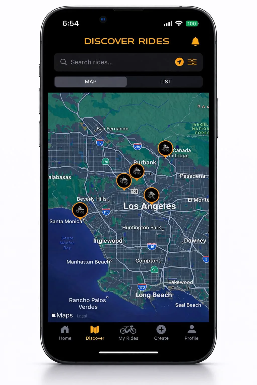
RideWolf is built for the rider who already knows the roads and has nobody to run them with. In Colorado that goes like this.
Early access for Colorado. No club dues, no forum lurking, no hoping the rider fueling up next to you at Poncha Springs is friendly.
We match you with riders on your side of the Divide, Front Range or Western Slope, who ride your pace and your kind of day.
Over Independence the week it opens, down the Million Dollar Highway when the aspens turn, and a Front Range canyon on every Saturday in between. Then park it, because the gates will.
Full disclosure: I have never ridden in Colorado. Not one pass. I’m an LA rider who started at 50 on a used Night Train, and the highest road I’ve run is a long way short of twelve thousand feet. Building this page I kept hitting the same two things: roads that would be the best ride of my year, and a state so big the people riding them might as well live in different countries. If you ride Colorado, get on the list and start it. I’ll be the one in the back asking what 12,000 feet does to a Harley that lives at sea level.
— Johnny, founder. Started at 50, rides a 2007 Harley Night Train.
Six months of the highest paved roads in the country, then a long winter to plan the next ones. Free to join, and the first 500 Colorado riders wear the Wolf Pack badge for good.
The Million Dollar Highway between Ouray and Silverton, the full San Juan Skyway loop, Independence Pass, Trail Ridge Road and Cottonwood Pass are the ones riders cross the country for. Add Wolf Creek Pass, the Silver Thread, Grand Mesa and Rim Rock Drive for the Western Slope and the south. All of them are paved; the exact lengths, high points and seasons are in the table on this page.
No. Riding between lanes of moving traffic is a Class A traffic infraction. Lane filtering is legal within tight limits since August 7, 2024: a two-wheeled motorcycle may pass stopped traffic in the same lane at 15 mph or less when the adjacent lanes are stopped too and the lane is wide enough. The permission expires September 1, 2027 unless the legislature renews it.
Only riders and passengers under 18 must wear a DOT-standard helmet with the chin strap fastened. Adults are not required to. Eye protection is mandatory for every rider and passenger regardless of age, and on a motorcycle a windshield does not count as a substitute.
When the first storm the plows can’t beat arrives, not on a fixed date. Independence Pass closed November 17 and Trail Ridge Road November 14 in 2025, Cottonwood Pass November 3, and Guanella after Thanksgiving. They reopened between April 16 and May 29, 2026. The ten-year range for Independence runs from October 25 to November 17. Check cotrip.org or call 511 before any high-pass ride from October on.
Yes. Rocky Mountain National Park requires a timed-entry reservation for all vehicles, including motorcycles, between 9 a.m. and 2 p.m. from May 22 through October 12, 2026, for a $2 fee on Recreation.gov. One reservation covers two motorcycles riding together, and riders crossing the road before 9 a.m. or after 2 p.m. do not need one. The park entrance fee is $25 per motorcycle pass for one day.
Nobody agrees. The state tourism office says it either cost a million dollars to build or has a million dollars of gold ore in the fill. Durango’s tourism office offers million-dollar views, or locals who wouldn’t drive it for less. Ouray’s office tells of three 1920s bids that totaled exactly one million dollars. CDOT, which maintains the road, gives no origin at all.
The Front Range has the most: dealer bike nights in Golden through the summer, the Pikes Peak HOG chapter’s first-Saturday ride in Colorado Springs, and the Colorado Motorcycle Expo in Denver each February. Beyond that the state is big and the riders are scattered, which is the problem RideWolf is built for: it matches you with riders on your side of the Divide who ride your pace. Early access is free by email.